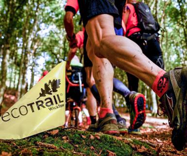

Course changes 2024 - Q & A
In our latest blog update, we sit down with Event Controller René Borg to get the lowdown on the changes and improvements to this year's EcoTrail race courses.

So we hear there are some changes being made to the course?
Yes, every year we have to or decide to make a few changes – sometimes small, sometimes larger and this year is no exception as we look to find improvements, adapt to feedback of the private landowners on whom we rely for access or feedback from National Parks.The individual race pages have been updated with these GPX files and descriptions now (so if people want to see them in full go there) and we will have hi-resoution maps available from our partners in EastWest Mapping around the 14th of September.
What’s the biggest single change this year?
We are introducing a new 10 km ‘hybrid’ route which consists of roughly 3 km of pavement and 7 km of trail. Since this route uses a new return route around Bray Head we decided to try and trial this as a return route for ALL the distances and see how the participants like it compared to the old route (where you returned over Bray Head the same way you came).
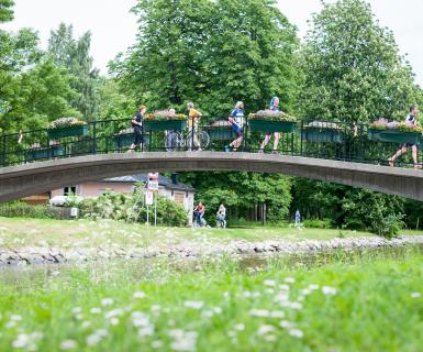
The trail on Bray Head has gotten very eroded in the last years which exposes roots that get extremely slippy when it rains. We have been looking for a different descent to spare that section of trail until it get’s repaired in the coming years and we think we found an interesting route.
Are the changes to improve the courses based on feedback?
There is an element of that but we have multiple things to consider when plotting out each year’s route. Much of our route runs through private land and we have to work with those land-owners on what route is available each year as you may have farm animals in the fields or – as happened last year – clashes with other events (Hell & Back in 2023) that use the same area.
Once we have an agreement on what route we can use we look which of the available options we think is the best experience for the runners and also consider what is easiest for the markers and marshals who have to control the area.
We also work with National Parks as sometimes trail works are ongoing or new trails become available and then we change the route accordingly.
We look at issues as well that can cause confusion (such as having a section where runners move in two directions – out and back) and see if there are ways to replace them with sections with less potential for ambiguity. For instance, the new section in Belmont this year has little to no two-way traffic whereas last year we worked around some constraints that forced us to adopt more such sections.
What are the specific changes this year?
There are quite a few, so I’ll list them for you here:
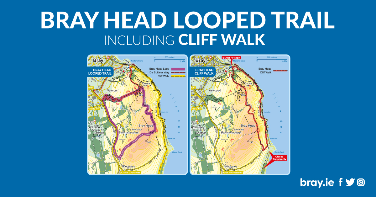
- - A new return route around Bray Head
- - A new more direct outbound route through Belmont and Kilruddery and avoiding the use of the stile over the wall and taking out a very technical rocky sectio
- - A small detour off the Sugarloaf Way to use a better and wider section of trail with superior views on the outbound trip around the Great Sugarloaf
- A return to the ‘direct descent’ to Powerscourt Waterfall instead of the longer shallower trail used in 2023.
- A new simpler layout of the Roundwood reservoir loop
- - A new return route near Lough Tay to bring the 80 km back over 80 km this year (it had dropped to about 79 km due to changes in 2024
- A new trail on parts of White Hill (which will be nearly completed for this year) as boardwalks are being replaced with 'proper trail' in that area. this will be ongoing in future years too

When we change the route we are always looking for a few things
- Will it make the running experience more straightforward
- Will the new trail be at least as scenic and enjoyable as the trail it replaces
Having run over the new sections, I am confident the changes tick those boxes and that most people will enjoy it. We'll obviously survey people after on their opinions and we're never afraid to return something to the way it was if we can see people preferred it that way.
What is the priority when selecting trails
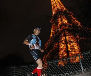
The ethos of EcoTrail is use sustainable trails where possible – meaning trails that can be heavily used without causing erosion or disturbance to sensitive ecological areas. The second priority is to link the urban areas to the natural areas as best exemplified in EcoTrail Paris where you run into the forests and parks around the greater metropolitan area.
So we try to use the waymarked trails created for such purposes wherever possible and we are delighted that the new change this year around Bray allows us to showcase the ‘Bray Head Loop’ trail and parts of the ‘Butler Way’ which we have not previously showcased as part of our routes.
We do want some challenge and don’t eschew difficult trails entirely but EcoTrail is not meant to be a hardcore brand like SkyRunning or most of the ‘by UTMB’ races, so we favour easier trails that people new to trail running can cut their teeth on when we have the option.
The new outbound section through the Kilruddery/Belmont estates is simpler, removes the need for our team to build a stile over a stone wall (and you to traverse it!) and cuts out a very technical rocky downhill. It also introduces a gorgeous view back at Bray and the seafront where you started just as you hit the 7 km mark.
Trails always change and we try to assess when a trail is in good condition to be used: A combination of rain and our teams efforts has cleared up the direct mountain bike path that leads runners in the 46 and 80 km down to Powerscourt Waterfall, so our team did a bit more work clearing debris, rocks and roots from the path and we are now happy to bring this back as part of the race. This change means we can cut nearly 1.4 km off the 47 km. Cutting this distance also allowed us to make some interesting changes to the 80 km further south.
Our team discussed what our vision for the second longest course was: should we just make it a 50k or should we try to shorten it again. We decided we wanted to ensure it was not ‘a full ultra’ which is what the 80 km is there for and looked at options to shorten it.

Finally what are some of the new highlights? Any drawbacks?
We’ve been able to shorten 19k, 30k and 47k a bit – especially the 47k which is now back down from 47.8 km to 46.5 km and such we call it the '46k again' (closer to the original which was intended as a 44-45k race) with the use of the direct trail discussed above. We also removed 5 km of ‘overlap’ (where you ran the same section out and back) which allows runners to see more of the Wicklow trails and while there is some camaraderie in cheering on outbound runners as you are on your way home (and viceversa) generally it is safer and more enjoyable for everyone to have as little two-way traffic as possible when running.
On drawbacks: To create the new loop around Bray Head, we have to go on a pavement for 1400m which some purist trail runners will probably enjoy less. But this is a nice section to take a breath and the rewards are great – you gain an entirely new climb to Bray Head summit along with the new descent to the promenade which takes you past the ruins of a 12th century church called Raheen-a-Cluig.
It’s important for us to try and take people past both natural and historical landmarks on the route – we partner closely with Wicklow Tourism and our race has to show off many of the county’s highlights.
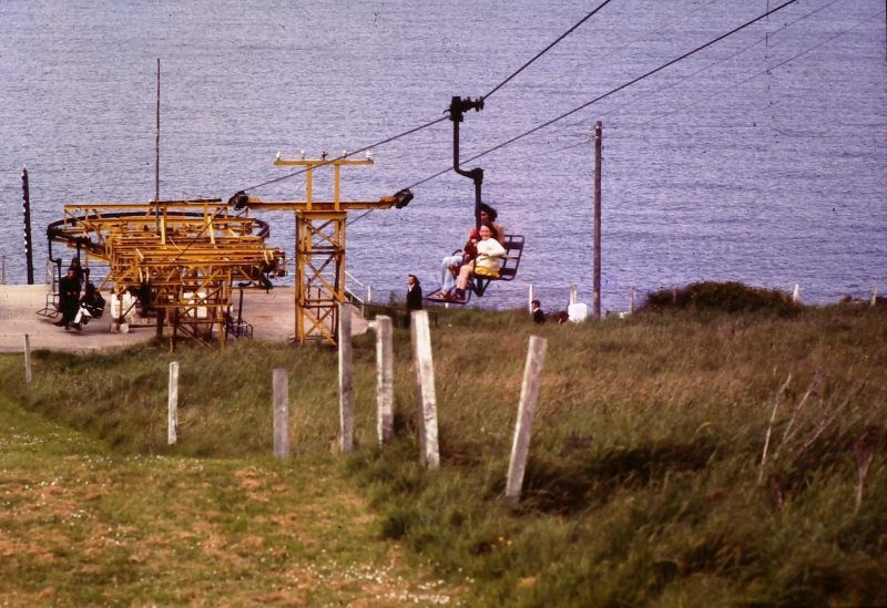
This new descent also uses an old disused staircase which we are working hard to have cleared and cleaned for race day. There is an interesting piece of history related to these stairs: they belonged to an old cable car that was in place on Bray head from 1952 to 1976. This was used to ferry people up to restaurant and ballroom called the ‘Eagle’s Nest’ which was halfway to the summit. Runners will descend just around where people used to dine and dance and where up to 300 passengers per hour were airlifted up nearly 50 years ago.
Checkout the new courses at Trace de Trail