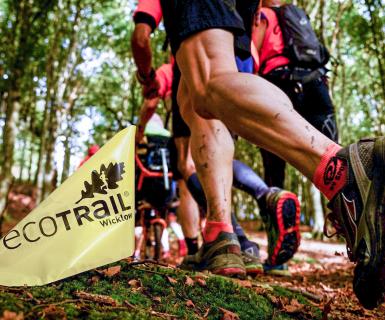

FAQ
The minimum age for particpation in the 10km distance is 17yrs+. All other distances are 18yrs +.
We are not in a position to ship any tshirts in any circumstances. If you want your tshirt your only option is to show up at registration before the race.
Your supporters will be able to track your progress along a number of intermediary checkpoints. A link will be uploaded closer to the event.
The checkpoints are as follows:
• 10 km: start / finish only (1 split of 10 km)
• 19 km: at 0, 9 and 19.8 km (2 splits 9 km and 10.8 km split)
• 30 km: at 0, 9, 14.8, 23.2 and 30.9 km (4 splits of 9 km, 5.8 km, 9.4 km and 7.7 km)
• 46 km: 0, 9, 14.8, 20.7, 31.5, 39.9 and 46.5 (splits of 9, 5.8, 5.9, 10.8, 8.4, and 7.6 km)
• 80 km: 0, 9, 14.8, 20.7, 33.8, 43.4, 63.8, 72 and 80 (8 splits of 9, 5.8, 5.9, 13.1, 9.6, 20.4, 8.2 and 8 km)
You can track participants here: https://wicklow-ecotrail-live-tracking.webflow.io/
Our timing team can see which runners pass which checkpoints although there can be a delay from the time a runner registers at a mat until the Race HQ can see their split time. If a runner does not show up in our system at a certain time it does not mean the runner is not there as timing chips may not register for several reasons the most common of which is a timing chip covered by clothing or a bag.
If during the race you need to provide priority updates to your supporters or emergency contact, your primary means of communication should be your mobile phone which needs to be carried at all times by all participants.
Yes, poles are allowed but may not be used in the start and finish area or on the first 2km including the climb up Bray Head.
Poles should also not be used while overtaking or while being overtaken.
When using the poles remember it is your responsibility to avoid hitting or tripping up other runners etc.
Please only use poles if you are experienced and well practiced in using them whilst running and walking
results from previous years
80 KM
- 2024 80km Results
- 2023 80km Results
- 2022 80km Results
- 2021 80 km Results
- 2020 race postponed
- 2019 80km Results
45 km/46 km/47 km
- 2024 46km Results
- 2023 47km Results
- 2022 46km results
- 2021 45 km Results
- 2020 race postponed
- 2019 45km Results
28 KM/29 KM/30KM
- 2024 30km Results
- 2023 30km Results
- 2022 30km Results
- 2021 29 km Results
- 2020 race postponed
- 28km Results 2019
18 KM/19 KM
- 2024 19km Results
- 2023 19km Results
- 2022 19km Results
- 2021 19 km Results
- 2020 race postponed
- 2019 18km Results
10km
For information on packages and special offers visit our 'Special Offers' page.
Once results are sent to ITRA they take ownership of all amendments. Please email them directly on contact@itra.run for changes to your ITRA results.
Note from 2022 onwards, we will only be affiliated as a UTMB qualifier and the race may not show up on the ITRA.RUN website.
The top-3 men and women in each race and the 1st placed category* finishers from outside of the top-3 (men and women) will receive an award
Prizes are given on the 'one person, one prize' principle so should an age category winner finish in the top-3, the second placed person in the category will receive the category winners prize.
Please note runners who change to shorter events during the event are not eligible for prizes.
*What are the categories?
Age categories are O40, O50, O60, and O70 for men and women. In order to qualify for a prize, a category must have at least two finishers. Should there be less than two finishers in a category, the lone person in that category competes instead in the lower category (i.e. if there is only one person over-70 in a race, they compete in the over-60 category). The male and female winner of each category receives the prize.
Note there are no separate Senior (under-35), O35 or junior categories. Any juniors in the race compete in the overall (under-40s) category.
Previous Event Results Are Available HERE
For details on transport and parking please refer to our transport page.
No
You are expected to carry everything you require for the duration of the race including food.
Water is available at the advised location for refil of your container only.
Please do not leave bags on the route as this is against race rules and will result in disqualification.
Personal/external support with provision of drinks, food, clothing, etc on the route is strictly forbidden.
Use of shops/cafes along the course is permitted.
We need to ensure the event is fair for all participating and external support is not "fair play".
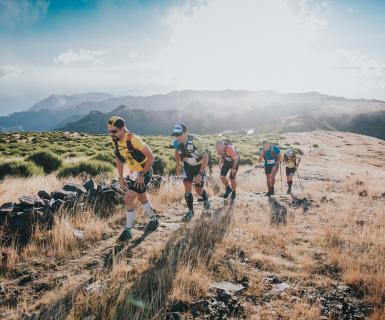
Trail shoes are strongly recommended for all distances in the EcoTrail Wicklow event
Regular road running shoes are not suitable for the mix of trail surfaces that are included in all distances.
These trails include significant sections of gravel, rocks, roots, grass and most likely mud particularly in case of recent wet weather.
There are some short sections of tarmac but these are relatively insignificant apart from in the 80km event
We do not have any mandatory qualifying event for the 80km course.
However, we strongly recommend that you should have successfully completed at least one 50+km off road running event in preparation for this significantly challenging event.
Please Do Not Enter This 80km Event unless you are adequately trained and experienced to safely complete the full course comfortably within the allowed time limits.
Yes, ITRA points and UTMB Index is provided for our races from 19 km and up. Note you still may need to fulfil other requirements to qualify for UTMB.
Our Race HQ is close to the Bandstand and in front of The Martello Hotel on Bray seafront.
This is 5 mins walk from the DART / Train Station
All participants must have registered online prior to entry closing - No On Day / Late Entry will be possible
All participants must sign on in order to collect their race bibs and timing chips on Friday evening or Saturday morning.
Participant Sign-on and collection of Race Bibs & Timing chips will be at the following times:
Friday (pre-race day) - From 16:00 -> 20:00
Saturday (race day) - From 06:30 -> 11:30
Race sign on for each event will close 30 mins before race start time.
To read the latest about this year's aid stations refer to this article.
Most of the route is on national waymarked trails and can be run by the public any time you should wish to do so.
A few sections cross private land only opened specifically for EcoTrail Wicklow.
Please do not attempt to run these sections at any time as this could lead to our race losing access to these sections.
Specifically, you must follow only the waymarked path through Kilruddery Estate / Belmont outside of race day and you must enter the Powerscourt Waterfall park only through the gate lodge (where you must pay admission fee).
When in doubt, please stay out thanks!
The start and finish line is at the Victorian band-stand on the sea promenade in Bray across from the Martello Hotel.
You will run along the promenade for 800m as you begin and end your journey to Bray Head and beyond.
Please contact us directly if you wish to make a large group booking - Email Us
No.
You can expect to encounter other trail and road users along your journey and show them the same courtesy you would like to receive under similar circumstances.
On all road sections stay aware of traffic and follow marshals instructions at all times particularly at road crossing points.
You may even be so lucky to encounter some of the Irish wildlife and livestock: fox, hare, rabbits, deer, badgers, squirrels, sheep, and wild goats all make their home in the National Park so share your journey and enjoy the experience.
The general rule in Irish trail and mountain races is that descending runners always have right of way as they are more at risk when changing direction or braking whilst descending.
If you encounter runners ahead of you on a single-track section, it is considered courteous to make way.
In practice there will be very little overlap of runners meeting on narrow trails but giving way is advised .
If faster runners from a longer event approach you from behind please also move to one side where possible and allow them to overtake safely.
Please do not attempt to overtake anyone on a narrow section of trail unless there is space to do so and / or the slower runner has indicated that you should pass.
For details on all cut-offs read our 'Top-4 things to know: Cut-offs' article
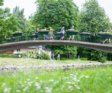
The routes start in the town of Bray and passes briefly through two other villages: Kilmacanogue (30, 46 and 80 km only) and Roundwood (80 km only). The rough proportion of the route that takes place running in urban areas are:
- 10km: 30%
- 19 km: 11%
- 30 km: 17%
- 46 km: 11%
- 80 km: 7%
The urban sections are very scenic such as the Bray seafront promenade encapsulating the start and finishing stretch of each race.
The current estimated percentage of the routes on tarred roads. With course improvements we have reduced the amount of tarred road in the race every year.
- 10km: 28.9% (3 km - longest stretch 900m)
- 19 km: 17.1% (3.3 km - longest stretch 900m)
- 30 km: 22.3% (6.8 km - longest stretch 1.5 km)
- 46 km: 23% (10.6 km - longest stretch 1.5 km)
- 80 km: 19.4% (15.4 km - longest stretch 2.2 km)
Much of these sections are parkland paths rather than actual roads and road sections are generally scenic country roads.
The following sections of our course are tarred:
ALL RACES
- Bray seafront promenade: 900m (out and back - 1.8 km total)
- Cliff Road to Windgates: 900 m
- Windgates estate: 300m
- Kilfenora Lane to Belmont Way: 300m
30 KM TO 80 KM
- Kilfenora Lane into Kilmac to Sugarloaf Way start: 1.5 km (out and back - 3 km total)
- Glencap Road: 500m
46 km and 80 km
- Red Lane (Great Sugarloaf): 700m (out and back - 1.4 km total)
- Ballyremon Commons: 700m (out and back - 1.4 km total)
- Powerscourt Laneway: 1 km
80 km only
- L1036 (Wicklow Wolf Brewery to Vartry Trails): 2.2 km (out and back 4.4 km total)
- Ford Bridge (Vartry): 400m
The longest single stretch of road is the 2.2 km leading from Wicklow Wolf Brewery to Vartry Trails Aid station.
For the shorter distances tarred sections are only 400m to 1 km in length.
Event entrants in all five race distances will receive a quality technical tshirt as part of their entry fee unless they have opted to have a tree planted instead - Details of the "Tree instead of a Tee" option HERE.
All finishers will receive a finishers tankard which you will hopefully find useful and enjoy using both at the finish line and afterwards
We aim to provide accurate distances for all event but being a trail event with significant off road and elevation gain and loss means that these distances cannot be guaranteed accurate to the nearest few meters.
Distance and elevation is first measured in a mapping software and then confirmed on the ground by a Stryd foot-pod - currently the gold standard in measuring trail races and significantly more accurate than GPS.
In general most GPS watches will come close to the official measurements but it depends on your GPS software, the satelitte coverage in your area, the recording mode you have selected on your watch or phone, and how well you run the 'optimal line' on the trail. Our official course measurers put great care to run the optimal lines while measuring the routes with the foot-pod.
The foot-pod contains an accelerometer which measures exactly how far the pod moves across space in three dimensions (forwards/backwards, side to side, and up and down) providing nearly 100% accurate readings even where there is poor satellite coverage. So should you find that your GPS recording is slightly different than official course distance and elevation it is likely a combination of GPS inaccuracy and not having run the optimal line on the trails (such as when you run the outside of bends instead of taking the straight line from the middle of each curve in the bend - not always an option when you are racing or tired).
It is possible to change to a shorter race distance up until 12th September as long as the shorter race you wish to join is not sold out.
Please note you will not be refunded the difference in price if you avail of this option.
To change to a longer race, you must pay the difference.
In both cases Distance Change Requests should be sent by email to info@ecotrailwicklow.com no later than 12th September
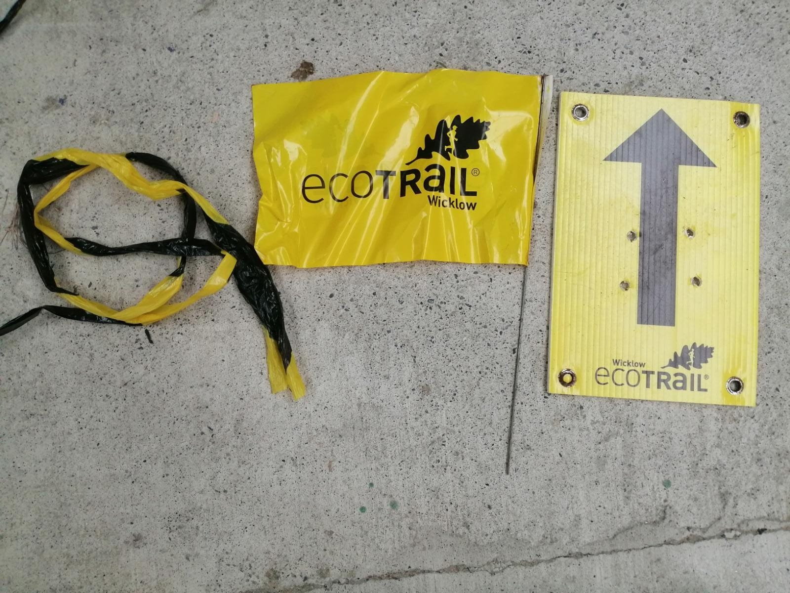
The courses are marked with a mixture a flags, reusable reflective ribbons, and arrow and information signs.
As a general rule the course will be marked at every junction or other area where you could be in doubt where to go.
Navigational skills are not necessary but it is vital that you remain aware of the need to follow the route marking and not assume that everyone that is ahead of you has done so.
If you reach a junction that has no race marking then you should retrace your steps until you find a junction with route marking and follow route from there
Whilst we will have some marshals out on the course at critical points like road crossings points, most trail junction will not be marshaled so you are responsible for following the marked route.
Please note that no amount of race marking is fool-proof: marking can be tampered with, blown away, or your line of sight to it can be blocked by other users of the trails (hikers, etc.) so we highly recommend downloading the GPX of each route as an additional backup confirmation if you arrive in a junction where you are uncertain how to interpret what you see.
To see the climb of this year's route please visit the route page for each race.
As the start and finish are in the same location, you will experience the same amount of descent in addition to this climb for all routes.
Basic maps of the route for each distance are provided on the individual race pages
Most of the route is on national waymarked trails and can be run by the public any time you should wish to do so.
A few sections cross private land only opened specifically for EcoTrail Wicklow.
Please do not attempt to run these sections at any time as this could lead to our race losing access to these sections.
Specifically, you must follow only the waymarked path through Kilruddery Estate / Belmont outside of race day and you must enter the Powerscourt Waterfall park only through the gate lodge (where you must pay admission fee).
When in doubt, please stay out thanks!
Unfortunately transfer to future years is not possible nor are refunds offered but you can transfer your entry to another person for free up to 13th September only
After this date no changes are possible
Please refer to the ‘Visit Wicklow - Accommodation’ page for general details.
Wicklow Tourism is working with local accomodation providers on packages for Eco Trail Wicklow participants and their supporters
Please click here for Entry Prices* for our 2025 EcoTrail Wicklow Event.
*All Entry Prices are subject to €4 charge to cover booking system and transaction charges
*All prices include the vat (Value Added Tax) that is applicable to your entry fee
* Entries will close whenever allocated spaces for each distance are filled
You can check your registration application at any time with the registration number indicated in the confirmation e-mail you received.
If you cannot find a confirmation mail please check all your e-maill folders
If you are sure you have entered and paid then drop a mail to info@ecotrailwicklow.com with all details you know of your entry including distance, date entered, etc and we will investigate
You can transfer your bib to another competitor up until 12th September 2025.
You can do this name change by sending us an e-mail request with the name of the person getting your entry, their DOB & Email
The new entrant will then need to complete ALL REMAINING information including emergency contact name and number by 12th September 2025.
After this date no name changes or distance changes are permitted!
After this time, no name transfers are permitted as we will have ordered personalised race bibs with timing chips.
Anyone that allows their race bib to be used by another person without formal transfer will be banned from future events.
Anyone that uses another person's bib without it's re-allocation being formally done will be marked as DNF and banned from future events
Name changes are subject to a €10 admin charge.
On-site registration will not allowed for any of the EcoTrail Wicklow events.
Only online registration prior to the event will be allowed - Register here!
Once our maximum entry limits are reached and registration has closed, it is no longer possible to get a bib as maximum capacity has been reached.
We do not intend having a waiting list for the next event
- Refunds or transfers to other events is not possible under any other circumstances unless the race does not take place due to Government imposed restrictions.
Your best option if you cannot attend but do not wish your entry to be unused is to transfer it to a friend by submitting a name change request on your entry to our support team prior to 12th September
This can be done by sending an e-mail titled "Name Change Request" to info@ecotrailwicklow.com BEFORE 12th September
Name changes are subject to a €10 admin charge
After 12th September personalised bibs & timing chips will be ordered and printed so any further change of names / entry transfers will not be possible.
Can I defer my entry to another event or future edition?
Deferment of your entry to another Eco Trail event or future years is not possible.
No - All participants must collect their own race bib an timing chip in person and must provide proof of identity (copy or original)
You are not permitted to use another person's bib in the event without an official transfer being completed by the Saturday the 12th September.
Yes
Race Bibs will be available for collection at the Race Start Area between 60 and 30 mins before your scheduled race start time
Race Start times are:
80km - 7:30
46km - 9:00
30km - 10:00
19km - 11:00
10km - 12:00
No.
All bibs must be collected in person either the day before the race (Between 16:00 and 21:00) or on race morning up to 30 mins before the start of your event.
We recommend each runner should leave their personal belongings in their own vehicle.
- Limited facility is provided for those arriving with public transport at Bray seafront.
- Phones form part of the mandatory kit and must be carried on your person throughout the event.
The bag must have a sticker with your race number - we will provide labels.
No responsibility is taken for loss of valuables or personal property left in this area - All items are left at your risk.
This is the same place you will deposit these bags prior to the event.
Please note there is limited facility for this and we encourage everyone to store your baggage in your vehicle where possible.
Yes
Professional photographers will cover the general event and many photos will be posted online after the event.
We are also likely to have specific areas covered with photographers so that you can purchase photos for your use, etc
Your race bib with timing chip, finisher’s memento, t-shirt (Or Tree Planted instead of Tee), and water at the aid stations and the finish line.
For all competitors the after-race "Hot Dish" can be purchased as a registration add-on.
All entry fees quoted are inclusive of VAT
We have several Aid stations (providing water and snacks like flapjacks, bananas, water melon, and fruit cake to complement the food you carry on your person) for the longer distances and a Water Station on the 19 km.
To learn where on the route they are and what you can provision yourself with at them, please read our detailed introduction ‘Meet our Aid stations’ with latest updates.
We recommend that all participants should plan to carry the food they will need for the duration of their event and treat additional Aid stations food (For 80, 46 and 30k events) as "treats" rather than rely solely on them!
All information on cut-offs can be viewed in this article
No
Verbal support only at designated points (Spectator viewing areas) is permitted but the EcoTrail® Wicklow rules requires runners to be semi-autonomous.
Assistance by the race organisers is only allowed at designated Aid Stations.
No external assistance at any point on the course or assistance at aid stations with food, drink, gear, pacing, etc is permitted.
Penalties will be imposed for breaches of these rules in order to have a fair competition for all.
This article covers details of the best recommended spots to cheer on runners: read article
Verbal support only at these designated points is permitted but the EcoTrail® Wicklow rules requires runners to be semi-autonomous.
Assistance by the race organisers is only allowed at designated Aid Stations.
No external assistance at any point on the course or assistance at aid stations with food, drink, gear, pacing, etc is permitted.
Penalties will be imposed for breaches of these rules in order to have a fair competition for all
Your finisher certificate will be available on the results page of our website a few days after the race.