

WELCOME TO ECOTRAIL WICKLOW 46 KM!
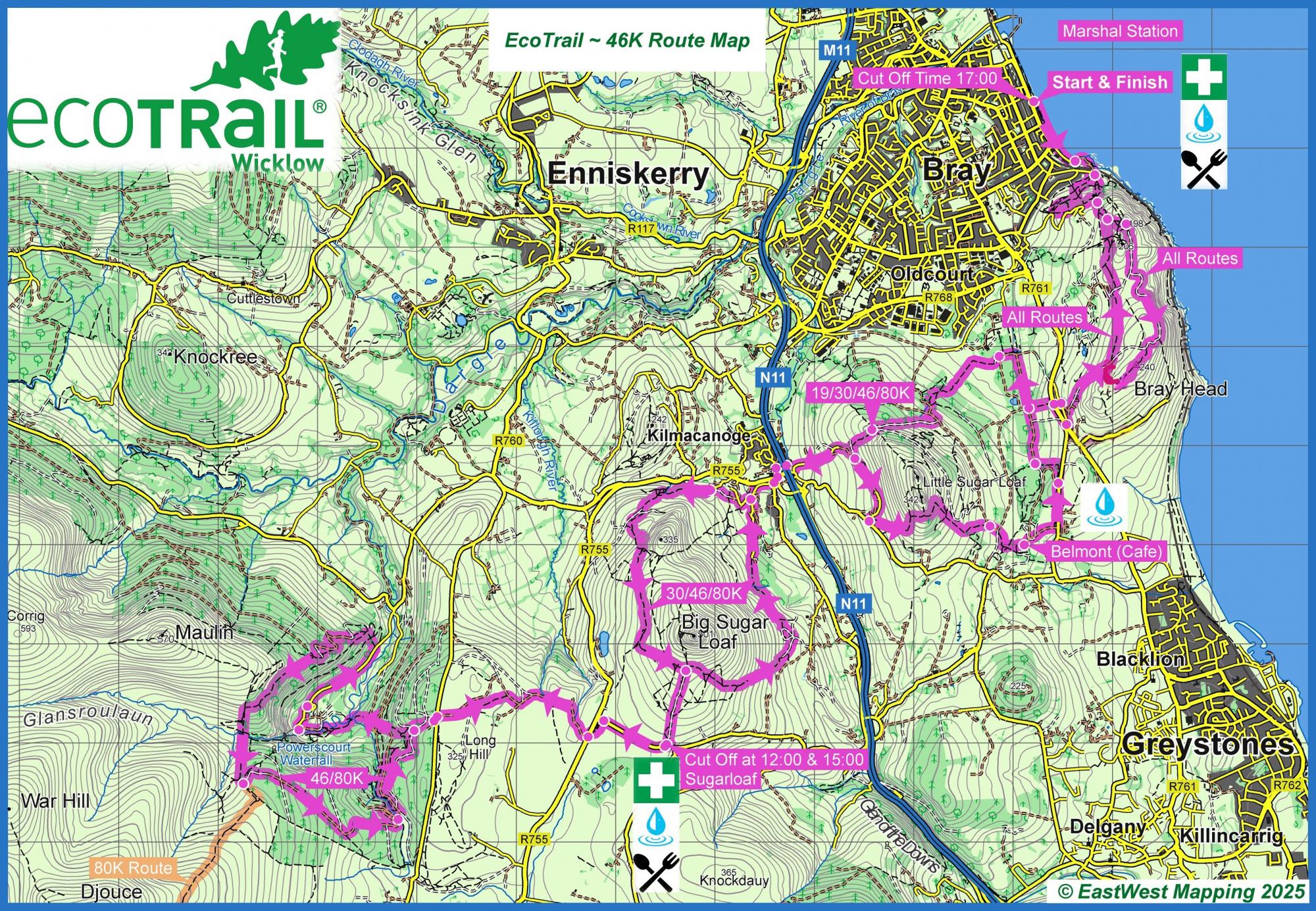
Like all our four race distances, our 46 km route begins on Bray harbour front. Leave behind the seaside promenade to tackle the steep climb to the iconic cross on Bray Head. Here you bid farewell to your views of the Irish Sea and turn towards the mountains proper.
You traverse mixed terrain trails across the Little and Great Sugarloaf Mountains, passing through the scenic Belmont Estate on-route to the Wicklow Way – a 132 km walking trail stretching south out of the Irish capital Dublin. Your journey home begins at the foot of the Powerscourt Waterfall and returns to Bray Head via Belmont Estate.
As you approach the finish line you will enjoy views across Dublin Bay before receiving a true Irish welcome at the finish line in Bray.
A general map of the route is provided for your information but this map is not intended to be used for access purposes.
Please do not access private sections of the route particularly in Kilruddery & Belmont Estates and Powerscourt Waterfall unless using their premitted public access routes
Cut-offs are in place for this route with an option to move on to the 30 km course at around 15 km if you fall behind them.
REGISTER for the Eco Trail Wicklow 46km Event HERE
The Track
Mandatory Equipment
Minimum 1 litre water container
- Food supply sufficient for the event
- A personal cup or bottle.
- Mobile phone (enter the safety numbers of the organisation into its directory, do not hide its number and do not leave without charged batteries for the mobile phone)
- Proof of identity.
- Wind / Rainproof Jacket
- Foil blanket
- Cap / Buff


